
Goal
Estimate great-circle distance and initial bearing between two geographic coordinates using a transparent spherical Earth model.
Worldwide context
Saved once here, used across the site.
Currency changes display only. Country selection guides tax input; no tax rate is guessed.
Estimate great-circle distance and initial bearing between two geographic coordinates using a transparent spherical Earth model.
a = sin²(Δφ/2)+cosφ₁cosφ₂sin²(Δλ/2); central angle c = 2atan2(√a,√(1−a)); distance = Rc; initial bearing = atan2(sinΔλcosφ₂, cosφ₁sinφ₂−sinφ₁cosφ₂cosΔλ).A clearer path to an answer
This page keeps the calculation transparent: define the goal, enter the matching values, inspect the method, and decide what the result means in your situation.
Estimate great-circle distance and initial bearing between two geographic coordinates using a transparent spherical Earth model.
Starting latitude · Starting longitude · Destination latitude · Destination longitude · Spherical Earth radius
a = sin²(Δφ/2)+cosφ₁cosφ₂sin²(Δλ/2); central angle c = 2atan2(√a,√(1−a)); distance = Rc; initial bearing = atan2(sinΔλcosφ₂, cosφ₁sinφ₂−sinφ₁cosφ₂cosΔλ).
Calculate, review the assumptions below, then compare a related tool when the decision needs more context.
Estimate great-circle distance and initial bearing between two geographic coordinates using a transparent spherical Earth model.
Open the Latitude and Longitude Distance Calculator pageMore science tools
Download PDFDownload Word (.doc)
Enter your values above and choose Calculate to see the result here.
Calculation map
a = sin²(Δφ/2)+cosφ₁cosφ₂sin²(Δλ/2); central angle c = 2atan2(√a,√(1−a)); distance = Rc; initial bearing = atan2(sinΔλcosφ₂, cosφ₁sinφ₂−sinφ₁cosφ₂cosΔλ).
Bounded, transparent calculation
Your recent runs stay in this browser session only.
Formula: a = sin²(Δφ/2)+cosφ₁cosφ₂sin²(Δλ/2); central angle c = 2atan2(√a,√(1−a)); distance = Rc; initial bearing = atan2(sinΔλcosφ₂, cosφ₁sinφ₂−sinφ₁cosφ₂cosΔλ).
The calculator treats Earth as a sphere and uses the shortest surface arc between the two points. It is useful for general planning, while surveying, aviation, maritime navigation, and long-distance geodesy may require an ellipsoidal geodesic solution.
Worked example: One degree of longitude along the equator is ≈ 111.195 km and the initial bearing is 90°.
The displayed limits are checked before the handler runs. Model-specific domain checks may also reject impossible or non-finite inputs.
Methodology: This calculator follows the WorldCalculate input, formula, precision, and boundary policy. Read the official methodology.
Calculator usage statistics
This section counts anonymous successful Calculate submissions, not unique visitors. Counts and top tools appear only when trusted aggregate data is available; country analysis is shown only under the same condition and reporting threshold.
Answer-first guide
Estimate great-circle distance and initial bearing between two geographic coordinates using a transparent spherical Earth model. Start with one clearly defined goal, enter values in the units shown, and keep the result attached to the assumptions below.
This tool is useful when your question includes latitude longitude distance, great circle distance, haversine calculator. It returns the outputs declared in the calculator contract rather than a live quote, approval, diagnosis, or professional sign-off.
Starting latitude · Starting longitude · Destination latitude · Destination longitude · Spherical Earth radius. Keep the same time period, unit system, and currency wherever the form requires comparable values.
Run the worked example first, compare its output with the page's example, then change one input at a time. This makes an unexpected result easier to trace to a unit, boundary, or assumption.
Need a wider view? Browse Science Calculators or compare the related tools below. The WorldCalculate methodology explains how formulas, examples, limits, and revisions are reviewed.
a = sin²(Δφ/2)+cosφ₁cosφ₂sin²(Δλ/2); central angle c = 2atan2(√a,√(1−a)); distance = Rc; initial bearing = atan2(sinΔλcosφ₂, cosφ₁sinφ₂−sinφ₁cosφ₂cosΔλ).
The calculator treats Earth as a sphere and uses the shortest surface arc between the two points. It is useful for general planning, while surveying, aviation, maritime navigation, and long-distance geodesy may require an ellipsoidal geodesic solution.
One degree of longitude along the equator is ≈ 111.195 km and the initial bearing is 90°.
Context and background
Science calculators define a system, choose an equation, apply units and constants, and show the substitution. Effects outside that model remain outside the result.
Introductory science problem solving builds from measured quantities and idealized relationships. Those models are valuable for learning and first-pass estimates, while experiments and engineering decisions need additional evidence.
Calculator guide
This guide is prepared from the published calculator contract so the formula, inputs, example, assumptions, limits, and next actions remain aligned with the live tool. It is a planning and learning aid, not a substitute for a professional, legal, medical, financial, safety, or official decision.

Short answer: This practical guide explains how the Latitude and Longitude Distance Calculator turns the values you enter into a transparent result, how to check the units and formula, and when a related tool or authoritative source is needed.
Picture a lab note being reviewed by someone who was not in the room: units, precision, method, and uncertainty must remain attached to the result.
By the end, you should be able to define the question, prepare the inputs, run the Latitude and Longitude Distance Calculator, and explain what the result means in the real situation. The goal is a checkable decision record—not a number detached from its units, date, assumptions, and limits.
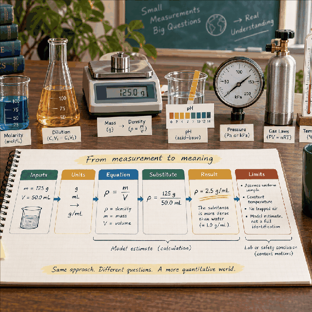
People usually arrive at this guide with a practical question, not a desire to see an isolated number. For this science and measurement work problem, write the decision in one sentence: what must be compared, planned, checked, or learned, and by when? Then write what a useful answer would change. If the result will not change a choice, the measurement or model may need to be simplified.
The Latitude and Longitude Distance Calculator is designed for a defined scenario. It uses Starting latitude, Starting longitude, Destination latitude, Destination longitude, Spherical Earth radius and returns the output stated in its contract. That makes the result reproducible, but it also means the answer is limited to the facts you enter. A calculator cannot fill an unknown value with a reliable guess simply because a search result sounds confident.
Make a small input worksheet with four columns: field name, value, unit or convention, and evidence or reason. The fields in this calculator are Starting latitude, Starting longitude, Destination latitude, Destination longitude, Spherical Earth radius. If a field has a hint or range, treat that text as part of the contract rather than as optional decoration. A value can be numerically valid and still be unsuitable if it describes the wrong period, person, surface, or denominator.
Use one source of truth for repeated values. For example, do not enter an annual total in one field and a monthly amount in another unless the formula explicitly expects that relationship. Keep full precision during intermediate work, record when a value was rounded, and do not hide a conversion inside an unlabeled number. When a value is estimated, label it as an estimate and create a conservative alternative.
Before pressing Calculate, read the form from top to bottom. Check sign, scale, percentage convention, starting point, endpoint, and whether a field is a total, rate, balance, quantity, or count. These checks make an answer easier to reproduce for a student, household member, client, teammate, or reviewer.
The declared formula is a = sin²(Δφ/2)+cosφ₁cosφ₂sin²(Δλ/2); central angle c = 2atan2(√a,√(1−a)); distance = Rc; initial bearing = atan2(sinΔλcosφ₂, cosφ₁sinφ₂−sinφ₁cosφ₂cosΔλ).. Read it as a sequence, not as a black box: identify the inputs, apply any conversion or normalization, perform the operation, and interpret the output in the requested unit. If the formula includes a rate or percentage, write its period beside it before substituting values.
The built-in example is a controlled test because it uses known values. Its input record is:
| Field | Example value |
|---|---|
| Latitude1 | 0 |
| Longitude1 | 0 |
| Latitude2 | 0 |
| Longitude2 | 1 |
| EarthRadiusKm | 6371.0088 |
Expected example interpretation: One degree of longitude along the equator is ≈ 111.195 km and the initial bearing is 90°. Compare the live result with this statement, then change only one input. If the example does not match, check the calculator version, field units, rounding, and copied value before building a personal scenario.
A good walkthrough explains what each operation means in the real problem. It also explains what the result does not mean. Keep the formula and the plain-language interpretation together when you export, cite, or discuss the calculation.
One scenario answers “what happens if these assumptions hold?” A decision usually needs at least three: a base case using the best-supported inputs, a conservative case that reflects an unfavorable but plausible change, and a decision case that represents the action you are considering. Keep all unchanged inputs identical so the difference has a clear cause.
| Case | Purpose | Change one named assumption |
|---|---|---|
| Base | Best current description of the question | Use the dated values you can support |
| Conservative | Test a less favorable outcome | Change rate, cost, quantity, time, capacity, or measurement with a reason |
| Decision | Test the action or target | Change the input that the decision can actually control |
Compare both the output and the changed assumption. A larger answer is not automatically better, and a smaller answer is not automatically safer. Ask whether the change is realistic, whether it creates a second-order cost, and whether another calculator or professional source is needed. Save the scenario name with the result so a later reader does not confuse a stress test with a forecast.
Start with a measurement plan: variable names, units, instrument or source, precision, independent and dependent quantities, and the equation that connects them. Substitute values with units still attached, then check whether the final dimension matches the quantity being reported.
Equation arithmetic is not a complete experiment, safety review, uncertainty budget, or scientific conclusion. Confirm methods, calibration, conditions, and domain-specific standards with the responsible teacher, lab, engineer, or researcher.
Reduce experimental rework by calibrating or checking instruments, recording significant figures, repeating a measurement when appropriate, and separating measured values from assumptions. Run a sensitivity case to see which input deserves better evidence before spending time collecting more digits elsewhere.
To test a saving honestly, record the baseline result, the changed input, the new result, and the cost of implementing the change. Do not count a saving twice by reducing two fields that represent the same action. If the tool does not model a fee, quality change, delay, risk, or opportunity cost, keep that item in the written decision note rather than implying it disappeared.
Small improvements become useful when they are repeatable. Set a review date, decide what evidence will show whether the assumption was right, and rerun the same scenario when the underlying value changes. A saved calculation is a decision record, not a promise that the world will keep the same inputs.
When the answer looks surprising, do not immediately change the formula. Recheck the problem in this order: field label, unit, time period, sign, percentage convention, denominator, starting value, endpoint, rounding, and model boundary. Then rerun the built-in example. If the example is correct but the personal result is not useful, the issue is probably the scenario definition rather than the arithmetic.
Use the declared assumptions as a diagnostic list:
Report a possible correction with the calculator name, every input and unit, the displayed result, the expected result, and the exact step where the interpretation differs. That evidence is more actionable than saying that a number “looks wrong.”
This tool can support:
Common questions include:
For shared work, send the question, inputs, units, scenario name, result, formula, assumptions, and date together. For learning, explain the substitution before the final answer. For a material decision, add the authoritative document or professional review that sits outside the calculator.
A durable record has a descriptive scenario title, the question it answers, the values entered, units and conventions, the formula or method, the displayed result, the date, and the next action. Include the version or page path when a calculation may be rerun later. If a value came from a quote, label, measurement, gradebook, training log, or experiment, keep that evidence with the record.
Review the record when an input changes, when the decision becomes more important, or when the result will be reused for another person. Do not silently edit an old result. Duplicate the scenario, change one assumption, and explain why the new answer differs. This creates an audit trail and makes the page useful beyond the first visit.
WorldCalculate keeps formulas, examples, assumptions, and boundaries visible so readers can learn the method. The final responsibility still belongs to the person, institution, professional, or authority that owns the decision.
If these checks pass, open the Latitude and Longitude Distance Calculator and run the scenario with your own values. Use a related tool only when it answers a clearly different part of the same problem.
Estimate great-circle distance and initial bearing between two geographic coordinates using a transparent spherical Earth model.
This guide connects the real problem in “Latitude and Longitude Distance Calculator” to the exact contract of the Latitude and Longitude Distance Calculator. Start with the question, then choose inputs that represent the same person, project, period, and unit system. A precise number cannot repair an input that describes a different situation.
Before calculating, read every label and hint. Keep annual, monthly, daily, per-serving, per-unit, and percentage values in the period expected by the field. If a field represents a rate, record the rate convention; if it represents a total, do not enter a balance or a per-unit value by accident.
Published formula: a = sin²(Δφ/2)+cosφ₁cosφ₂sin²(Δλ/2); central angle c = 2atan2(√a,√(1−a)); distance = Rc; initial bearing = atan2(sinΔλcosφ₂, cosφ₁sinφ₂−sinφ₁cosφ₂cosΔλ).
The calculator treats Earth as a sphere and uses the shortest surface arc between the two points. It is useful for general planning, while surveying, aviation, maritime navigation, and long-distance geodesy may require an ellipsoidal geodesic solution.
The useful review question is not only “what number appeared?” It is “what does this number represent, which inputs produced it, and which important facts are outside the model?” Keep the formula, units, rounding, and assumptions beside any result you save or share.
Run the built-in example first so the article and the live calculator can be compared. The supplied example inputs are:
Expected contract result: One degree of longitude along the equator is ≈ 111.195 km and the initial bearing is 90°.
After the example matches, change one input at a time. That isolates what moves the answer and gives you a simple sanity check. If the output changes in a way the formula does not explain, stop and inspect the units, sign, endpoint, rate, denominator, or chosen calculator.
Build a base case, a conservative case, and a decision case. Keep the unchanged inputs identical and name the one change: a different rate, target, quantity, time horizon, distance, cost, workload, or measurement. Record both the result and the assumption that changed. This makes the tool useful for learning and planning rather than turning one output into a promise.
Use the result to choose a next question. A home estimate may need a budget and debt view; a recipe quantity may need a pan or cooking check; a health estimate may need personal context; a statistical result may need a design or sampling check; a construction quantity may need product coverage and site measurement. The related tools below are deliberately connected by topic.
The calculator’s declared assumptions are part of the answer:
Do not add facts the calculator does not collect. WorldCalculate does not silently know a lender’s approval policy, a country’s tax rule, a person’s diagnosis, a product’s live price, a school’s grading policy, a weather station, or a construction site. Replace planning assumptions with authoritative documents or qualified advice when the decision is regulated, safety-critical, medical, legal, or financially material.
Estimate great-circle distance and initial bearing between two geographic coordinates using a transparent spherical Earth model.
a = sin²(Δφ/2)+cosφ₁cosφ₂sin²(Δλ/2); central angle c = 2atan2(√a,√(1−a)); distance = Rc; initial bearing = atan2(sinΔλcosφ₂, cosφ₁sinφ₂−sinφ₁cosφ₂cosΔλ). The calculator treats Earth as a sphere and uses the shortest surface arc between the two points. It is useful for general planning, while surveying, aviation, maritime navigation, and long-distance geodesy may require an ellipsoidal geodesic solution.
Enter Starting latitude, Starting longitude, Destination latitude, Destination longitude, Spherical Earth radius, then choose Calculate.
Latitudes and longitudes are decimal degrees, with north and east positive under the usual convention. The selected Earth radius is spherical and does not represent a specific geodetic datum or elevation. The bearing is the initial great-circle bearing measured clockwise from true north; local magnetic variation and route constraints are not modeled.
Open the Latitude and Longitude Distance Calculator, enter the worked example, then replace one value with your own. Save the result with its date, units, assumptions, and the question it answers. If the result is used for a high-stakes decision, take the saved calculation to the person or organization responsible for the final decision.
Estimate great-circle distance and initial bearing between two geographic coordinates using a transparent spherical Earth model.
a = sin²(Δφ/2)+cosφ₁cosφ₂sin²(Δλ/2); central angle c = 2atan2(√a,√(1−a)); distance = Rc; initial bearing = atan2(sinΔλcosφ₂, cosφ₁sinφ₂−sinφ₁cosφ₂cosΔλ). The calculator treats Earth as a sphere and uses the shortest surface arc between the two points. It is useful for general planning, while surveying, aviation, maritime navigation, and long-distance geodesy may require an ellipsoidal geodesic solution.
Enter Starting latitude, Starting longitude, Destination latitude, Destination longitude, Spherical Earth radius, then choose Calculate.
Latitudes and longitudes are decimal degrees, with north and east positive under the usual convention. The selected Earth radius is spherical and does not represent a specific geodetic datum or elevation. The bearing is the initial great-circle bearing measured clockwise from true north; local magnetic variation and route constraints are not modeled.
This calculator is part of the WorldCalculate library. Its formula, example, assumptions, input bounds, and output formatting follow the official methodology.
These WorldCalculate collections connect this tool with related questions while keeping each calculation separate and transparent.